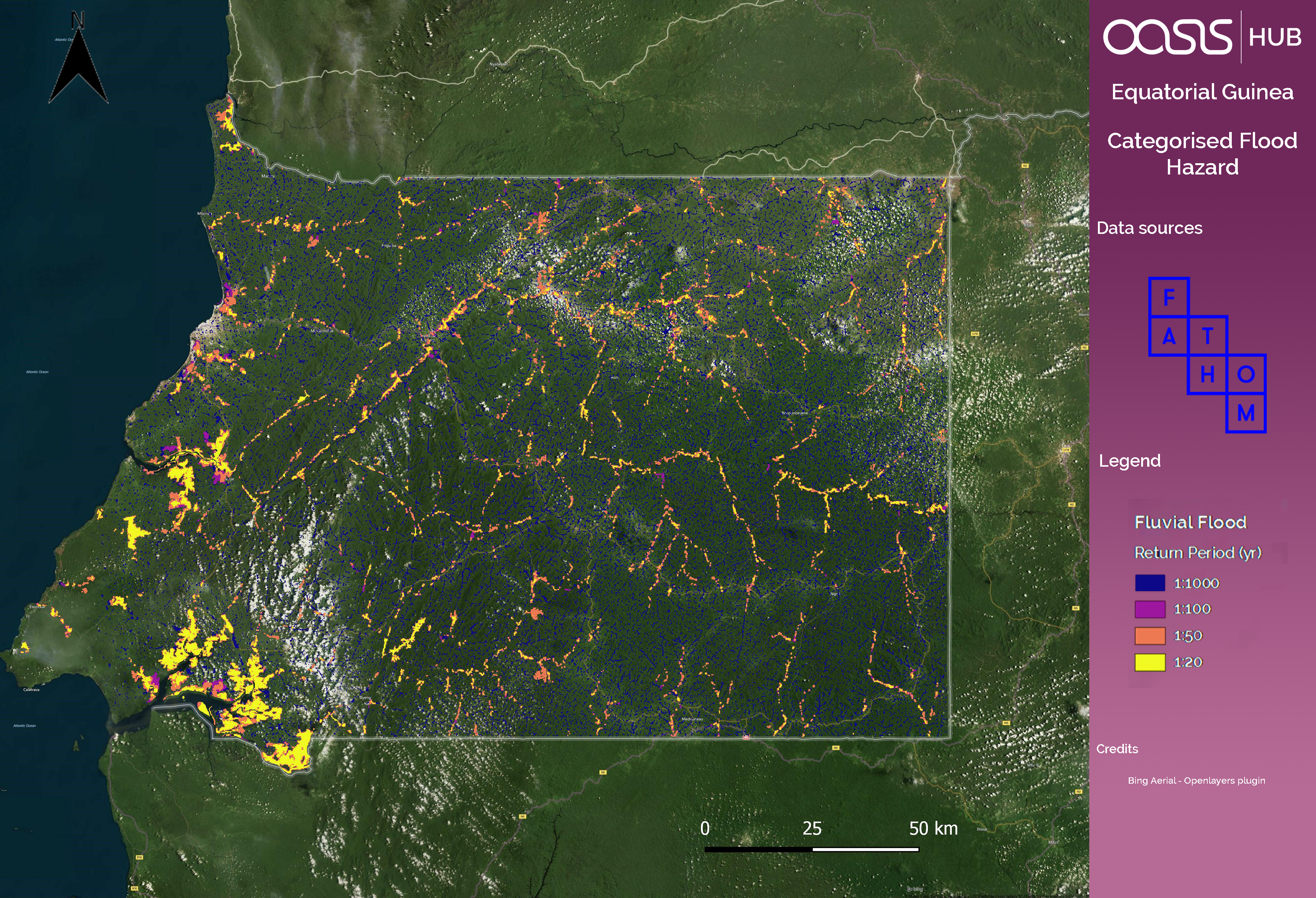
Equatorial Guinea Sample Map
Categorised flood hazard map of Equatorial Guinea
Additional Information
| Field | Value | |
|---|---|---|
| Last updated | June 29, 2017 | |
| Created | June 29, 2017 | |
| Format | GIF | |
| License | Creative Commons Attribution | |
| DOI | - | |
| Is sample? | False | |
| created | over 8 years ago | |
| format | GIF | |
| has views | 1 | |
| id | ba6e220c-9df2-4816-88d3-f6d55c3e0c82 | |
| on same domain | 1 | |
| package id | 231e8ee2-b039-422d-bc94-00d07132f6b7 | |
| revision id | 2b44dc58-4875-4982-a41a-c6f669ff8bb8 | |
| security type | open | |
| state | active | |
| url type | upload |