Advanced future-facing flood risk data and analytical services go live on Oasis Hub
With the new addition of digital services provided by flood specialists Ambiental Risk Analytics the Oasis Hub data portal is further equipped to support users in addressing global flooding challenges and understanding how climate change is predicted to increase flood risk.
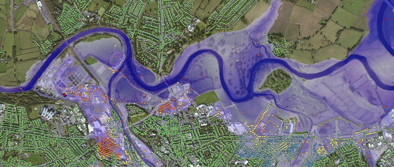
Ambiental FloodFutures® is a first of its kind flood map which presents a nationwide view of how predicted climate scenarios will modify flooding regimes. It provides a view of present-day flood hazard alongside three climate change scenarios which describe the range of possible outcomes at multiple time epochs up to the 2080s.
FloodFutures® is available now in the UK as a global capability to support global climate resilience. Developed using prevailing science it is supporting utility companies in appraising long-term infrastructure decisions and is increasingly of interest to the insurance and finance sectors as they seek to understand how risk characteristics will change.
Ambiental FloodMap™ flood hazard maps are typically built using high precision LiDAR terrain, providing step changes in accuracy for territories which include the UK, Ireland and Australia and Malaysia. Fluvial, pluvial and tidal layers are available. By linking flood hazard to exposure Ambiental FloodScore™ provides a database view of risk. This can be associated with open address and map data, or commercial exposure datasets and client portfolios. It provides summary scores of risk as well as detailed break downs of flood depths at a range of statistical return periods.
FloodCat™ is a property-level precision flood catastrophe model. Oasis Hub now includes Australia FloodCat™. Built for the reinsurance industry and available ready for use in the Oasis Loss Modelling Framework it incorporates data from FloodMap and FloodScore to provide a consistent view of risk across datasets.
The breadth of analytical services available on Oasis Hub is expanded through the addition of Ambiental FloodWatch. Delivered through automated dashboard systems and with a flood forecasting engine at its core, it is able to present risk visualisations and forecasts several days in advance of flood events. Operational for Malaysia, Australia and the UK with a global capability upon enquiry.
Tracy Irvine, Managing Director and co-founder of OasisHub.co said “The addition of further high precision datasets which describe flood risk now and in the future represent even more tools available to our users with which to interpret risk to protect people, property and the environment.”
Justin Butler, CEO of Ambiental Risk Analytics, added: “Oasis Hub represents an important resource for the risk community in understanding and unlocking the often disconnected and hard to discover data resources which are available. By bringing Ambiental data and services to the portal, we ensure our products are discoverable for those who require them for managing flood risk and preparing for a changing climate”.
Ambiental is a company of Royal Haskoning DHV which provides risk management, data and systems for analysing and advanced warning of meteorological and natural hazards.
TRY THE FLOOD MAPS, RISK DATABASE, CATASTROPHE MODELS AND ANALYTICS TOOLS.
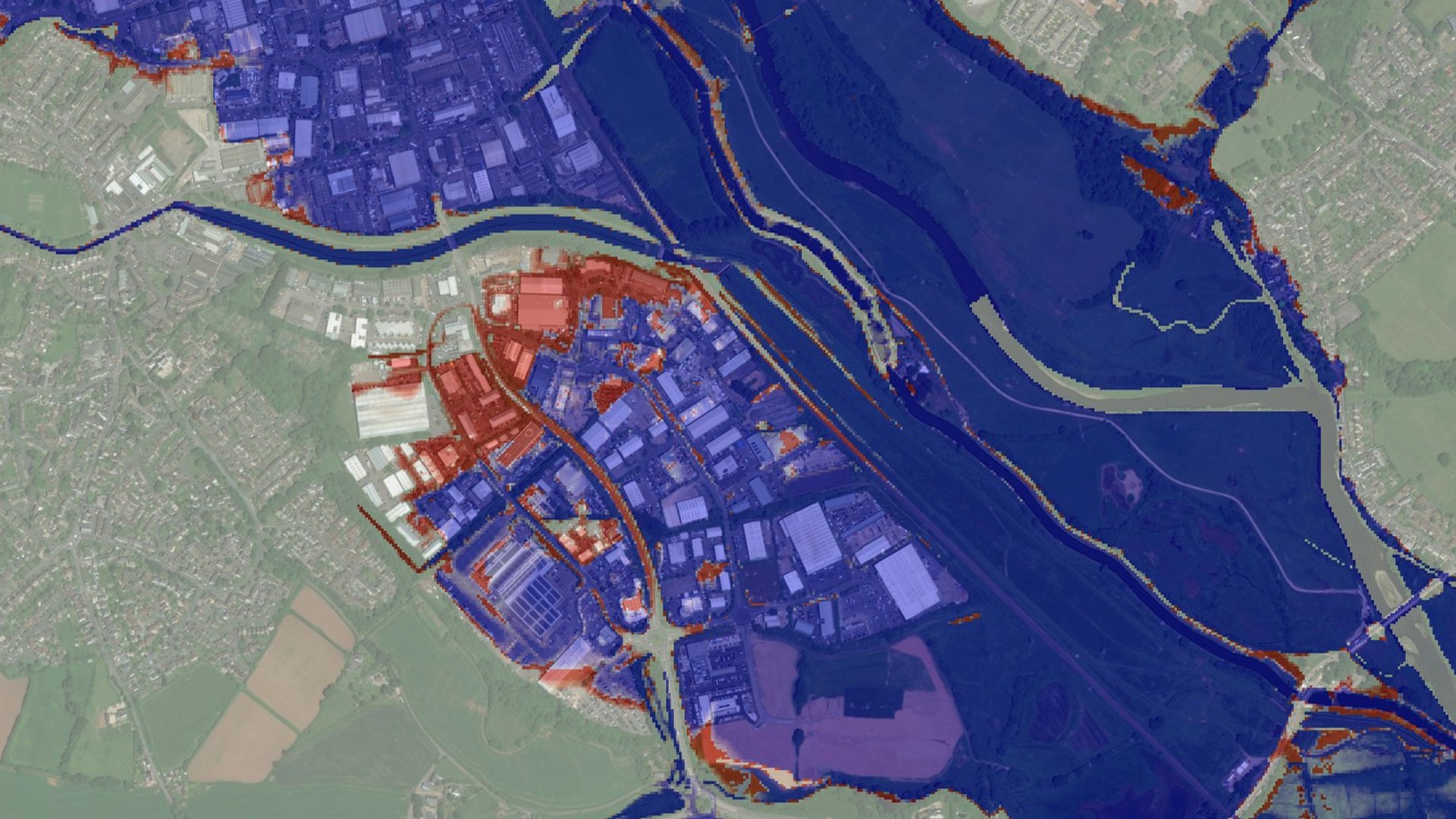
FloodFutures® fluvial 2017 Vs 2080 High Emissions – Current 1 in 100 year flood extent shown in blue increases in the 2080s flood extent shown in red
Ambiental Risk Analytics