Hurricane Harvey
Damage
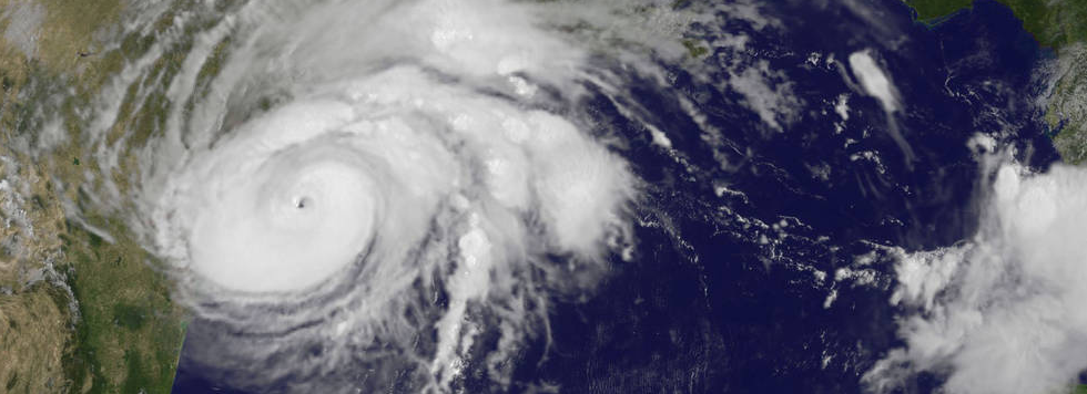
At the time of writing (16:00 Wednesday 30th August) Harvey has caused at least 30 confirmed deaths, 1 in Guyana and 29 in the United States. The Greater Houston area is experiencing catastrophic flooding and the hurricane has just made landfall again in Western Louisiana with further heavy rains. JP Morgan and others estimate the economic losses to be from $10 billion up to $50 billion.
According to statistics from the National Flood Insurance Program, 85% of the homes in Harris County, which includes Houston, do not have flood insurance. Officials from the Harris County Flood District, Harvey caused the third 500-year flood in 3 years.
A Community Response
Events of this type have a way of galvanising support from across a range of divides and boundaries.
We’ve been working with a number of our partners including SSBN who’ve released footprint data at 30m resolution, JBA Risk, has made Surface Water Flooding and Storm Surge Flooding data available, and AON Benfield Impact Forecasting has provided Inland Flood data. More partners are working on making their data available through Oasis Hub.
See the table below for a full list of available data.
We’ll update this regularly, so keep checking back.
|
Data |
Type |
Provider |
|
Shapefile/TIF |
JBA Risk |
|
|
Shapefile/TIF |
JBA Risk |
|
|
Fluvial & Flash Flood
footprint from Hurricane Harvey
in August 2017 |
TIF |
SSBN |
|
Inland
Flood Extent For Eastern Texas Riverine & Flash Flood . |
Shapefile |
AON Benfield Impact Forecasting |